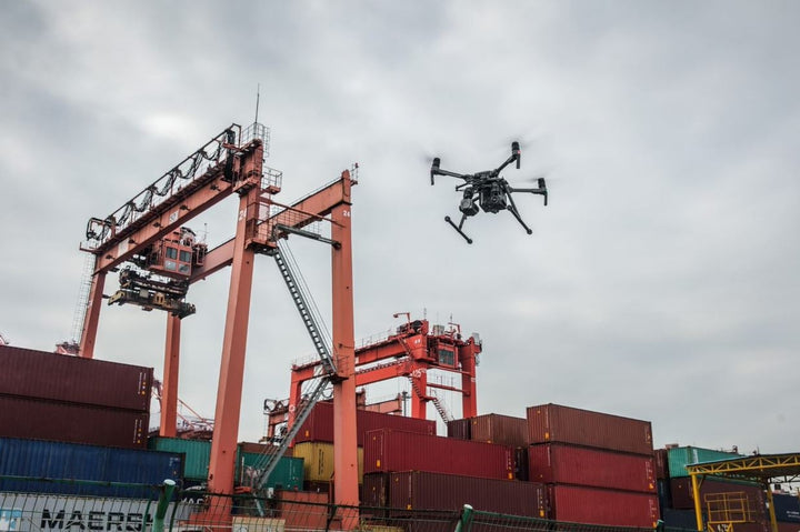

Best DJI Drones for you | Unmanned LLC
If you're looking to get into photography with a drone, DJI is the brand for you. They make some of the best drones on the market, perfect for capturing amazing aerial photos and videos. In this post, we'll take a look at some of the most popular DJI drones made specifically for photography. We will also discuss the best drones for Agriculture, Industry, and Commercial sale. So, whether you're a beginner just starting out or an experienced pilot, there's sure to be a drone in this list that's perfect for you!
Condensed Verion of our Best Drones with just Links!
BEST DJI DRONES FOR YOU | UNMANNED LLC CONDENSED – unmanned.store
Flagship Camera Drone
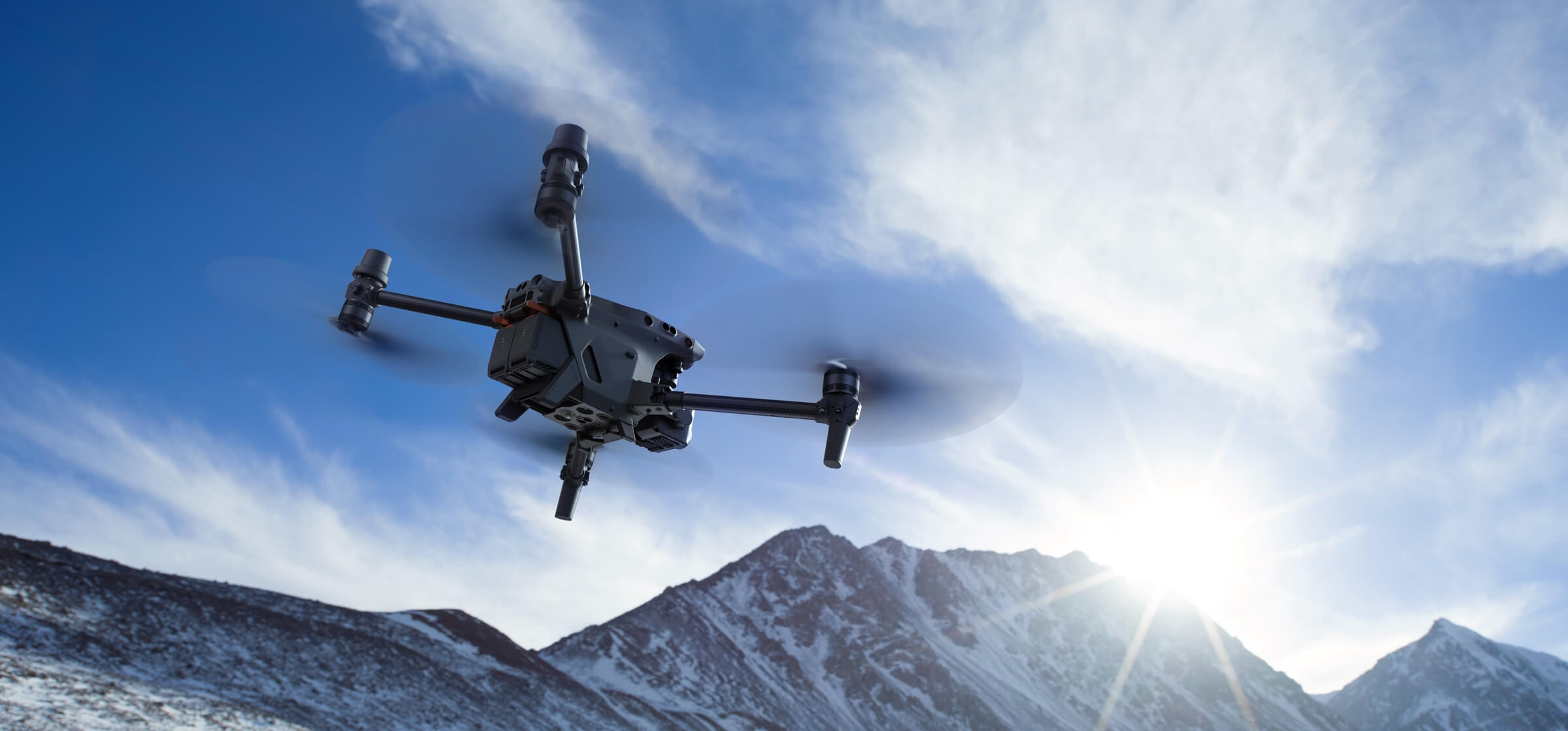
DJI MAVIC 2 ENTERPRISE ADVANCED
DJI Mavic 2 Enterprise Advanced – unmanned.store
Capture accurate details in any mission with the Mavic 2 Enterprise Advanced – a highly versatile yet compact tool that packs a whole lot of performance upgrades. With high-resolution thermal and visual cameras, the M2EA supports up to 32× digital zoom and is capable of centimeter-level positioning accuracy with the RTK module. Expand your vision with advanced dual-cameras
HIGH-RESOLUTION THERMAL
Make informed decisions by quickly identifying objects onsite using the M2EA’s integrated high-resolution thermal sensor, which supports Spot Meter and Area Measurement.
-
640 × 512 Thermal Resolution
-
30Hz Frame Rate
-
16× Zoom
-
±2 °C Temperature Measurement Accuracy

ZOOM IN TO STAY SAFE
Capture clear images and videos from a safe distance. The M2EA’s high-resolution visual camera supports ultra zoom, so no detail is missed.
-
48MP Visual Camera
-
1/2” CMOS Sensor
-
4× Lossless Zoom
-
32× Digital Zoom
DUAL-VISION AT YOUR SERVICE
Tap to switch between visual, thermal, or split-view feeds for different project needs.

COMPACT YET POWERFUL
Achieve centimeter-level accuracy using the M2EA with the RTK Module3. Create up to 240 waypoints to conduct automated, detailed inspection missions in complex environments.
MAXIMUM FLEXIBILITY
The lightweight and portable M2EA can take off in less than a minute. Zip through complex operating environments thanks to the faster ascent and descent speed.
APPLICATIONS
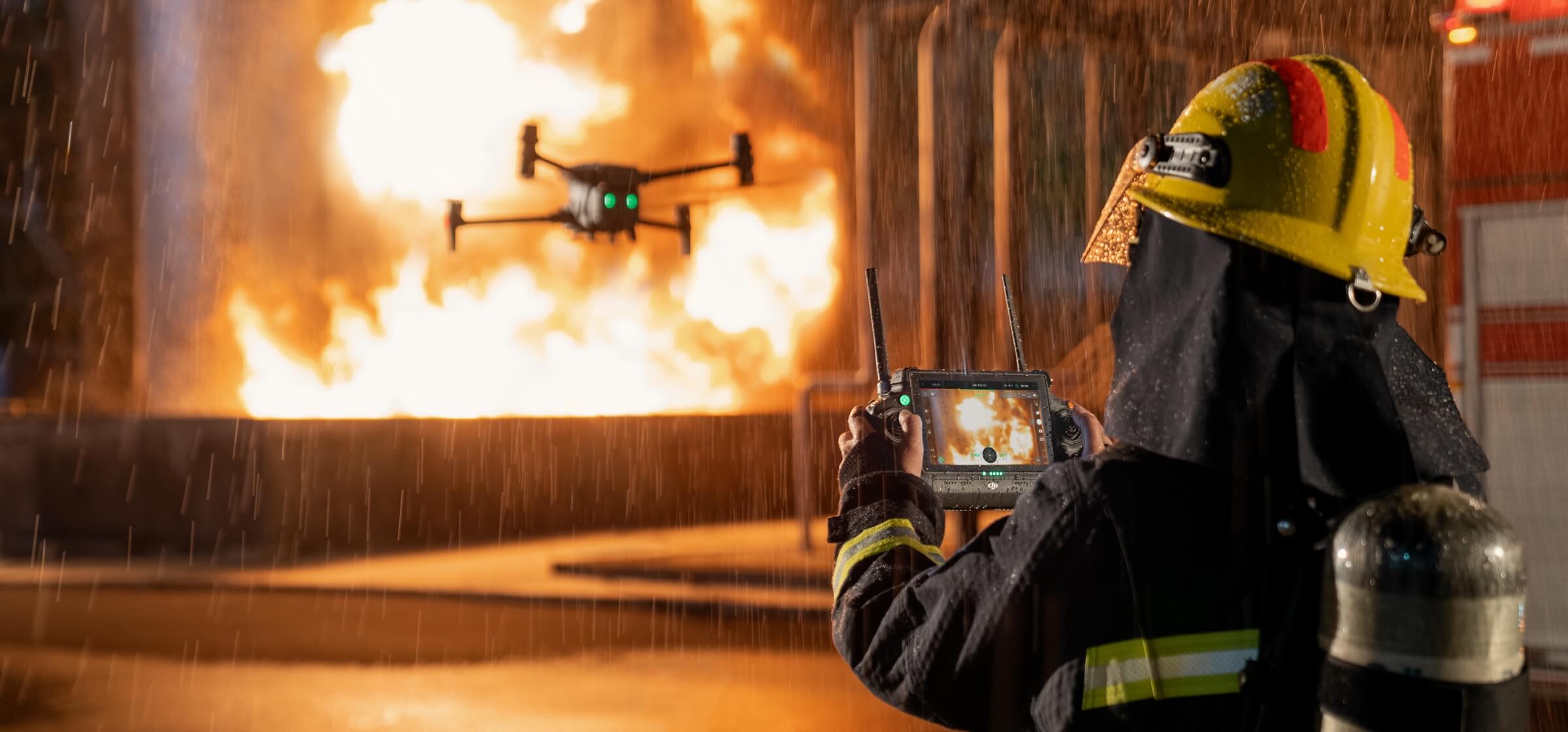
Firefighting
Quickly locate victims, identify hot spots, and screen for fire risks to draft targeted rescue plans while keeping personnel safe.
Search and Rescue
Scan search areas to locate stranded persons and quickly dispatch rescue teams.
Law Enforcement
Gain critical intel in conflicts or emergencies to make timely and informed decisions without putting teams in harm’s way.
Power Inspection
Pinpoint defects and identify risks on equipment to effectively monitor operations and improve efficiency in inspection and maintenance.
Environmental Protection
Monitor changes in the environment to facilitate wildlife protection.
All Around
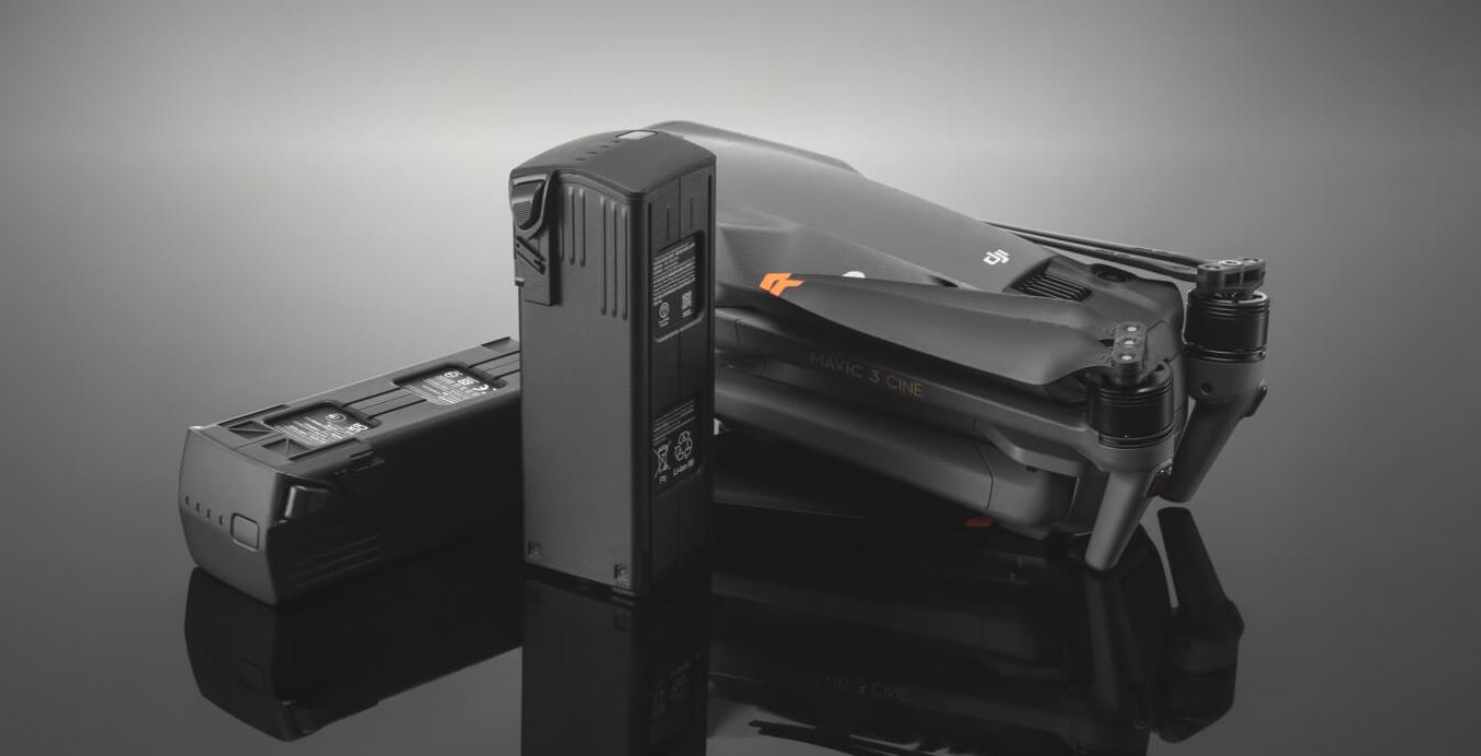
DJI MAVIC 3 CINE PREMIUM COMBO
DJI Mavic 3 Cine Premium Combo – unmanned.store
IMAGING ABOVE EVERYTHING
SEEING IS BELIEVING
-
4/3 CMOS HASSELBLAD CAMERA
-
5.1K APPLE PRORES
-
OMNIDIRECTIONAL OBSTACLE SENSING
-
Capture stunning imagery with the legendary Hasselblad camera and enjoy a smooth flight with omnidirectional obstacle sensing. Every improvement on Mavic 3 sets a higher standard for aerial photography. Fly with Mavic 3 and discover imaging above everything.
TWO CAMERAS, UNLIMITED POSSIBILITIES
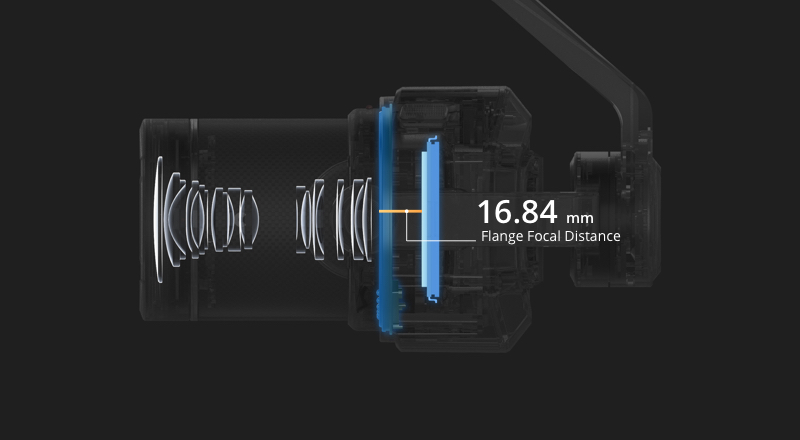
HASSELBLAD L2D-20C CAMERA

Old Legend, New Chapter
The iconic Swedish brand Hasselblad designed and built the L2D-20c aerial camera just for DJI Mavic 3, embedding a professional-grade 4/3 CMOS in an unbelievably compact space. Rigorous Hasselblad standards are applied to both hardware performance and software algorithms, bringing imaging quality to an entirely new level.
-
20MP PHOTOS
-
12.8 STOPS OF DYNAMIC RANGE
-
F/2.8-F/11 ADJUSTABLE APERTURE
-
24MM EQUIVALENT FOCAL LENGTH
-
VDAF VISION DETECTION AUTO FOCUS TECHNOLOGY

4/3 CMOS Built for Masterpieces
A larger image sensor not only gives Mavic 3 higher resolution and dynamic range, it also more effectively suppresses noise in low-light environments.
12.8 Stops of Dynamic Range for Optimal Image Quality
The 4/3 CMOS sensor comes with a high 12.8-stop dynamic range to retain more details in highlights and shadows, upgrading your work to a professional level.
Adjustable Aperture For Every Scene
Aperture is adjustable according to the needs of different scenes. In low-light environments, the f/2.8 aperture lets more light in; when the lighting is sufficient, aperture can be adjusted to lower the shutter speed for recording smoother, more natural footage.
Wider FOV to See the Bigger Picture
Weighting less than 13 g, the 24mm equivalent lens not only supports autofocus, it also has a 84° FOV to capture more in every frame.
Focusing is faster with VDAF Technology.
The Hasselblad camera on Mavic 3 features Vision Detection Auto Focus (VDAF) technology, which works with multiple vision sensors to utilize distance data and optimize focusing speed.
HASSELBLAD NATURAL COLOUR SOLUTION
Mavic 3 features the Hasselblad Natural Colour Solution, which is the result of decades of photographic experience, resulting in vivid, natural colors with the simple press of the shutter.
Excellence without Presets
Complex color presets have never been part of Hasselblad’s philosophy, neither of Mavic 3. Starting from the pixel level of sensors, Hasselblad developed the Hasselblad Natural Color solution (HNCS), a new perspective to handle a variety of scenes by easily reproducing accurate and natural colors.
Pixel Calibration for Ultimate Image Quality
To ensure Mavic 3 captures natural colors in the same way other Hasselblad cameras do, the L2D-20c lens adopts the same rigorous standards and has every pixel of the sensor calibrated, with the HNCS embedded.
Accurate Color Reproduction
During shooting, RGB color data obtained by the sensor will be converted through Hasselblad's unique image processing algorithm and color processing mode so that natural colors in various scenes can be precisely reproduced without any presets.
RESULTS THAT SPEAK
Create professional imagery with the well-built Hasselblad L2D-20c camera system. Higher dynamic range allows for a more natural transitions between highlights and shadows, preserving rich visual information with a greater sense of depth. A larger sensor size keeps images clean in low light.
PROFESSIONAL VIDEO SPECIFICATIONS
-
5.1K VIDEO RECORDING
-
DCI 4K/120FPS
-
APPLE PRORES 422 HQ
-
10-BIT D-LOG COLOR PROFILE
Mavic 3 not only records aerial videos at high resolution and framerates, but also captures 1 billion colors with 10-bit D-Log color profile, presenting a more natural gradation of sky colors with more details retained for greater flexibility in post production.
The Mavic 3 Cine supports Apple ProRes 422 HQ encoding [2] with a maximum data rate of 3772Mbps. In addition, it also supports a built-in 1TB SSD [3] and 10Gbps lightspeed data cable to further facilitate professional filming and creation.
28x Hybrid Zoom | 162 mm, f/4.4
Activate Explore mode to unlock Mavic 3's second camera – a unique tele camera that lets you effortlessly scout and plan your shots. When scenes or subjects are far away, use the tele lens to zoom in and save time, or record from a distance without disturbing the subject.
TOTAL FLIGHT PERFORMANCE | ENHANCED SAFETY
Omnidirectional Obstacle Sensing
Mavic 3 ensures you a collision-free flight, and all you need to do is focusing on shooting itself. Multiple wide-angle vision sensors onboard work seamlessly with a high performance vision computing engine to sense obstacles in all directions [4] precisely and plan a safe flight route that avoids them.

Advanced RTH
Always end on a high note with Advanced RTH. Obstacles along the way back to the home point are easily detected and avoided. With the brand new Advanced RTH, Mavic 3 will automatically figure out the optimal route to avoid obstacles and return to home safely.
Whether activated by the user or triggered by signal loss, Mavic 3 can easily return to the home point safely in adequate lighting conditions.
DON’T JUST FLY, ENJOY
APAS 5.0
Mavic 3 makes flight more fun than ever with recording that is no longer interrupted by obstacles along the way. When flying, Mavic 3 continually senses objects in all directions and bypasses them quickly and smoothly.
O3+ TRANSMISSION AND BEYOND
46 Minutes Extended Flight Time
Execute every step, from flight route planning to composition and even record a timelapse video, all during a single flight. Compared with the previous generation, Mavic 3’s wind resistance has improved by 35%. It also uses motors and propellers with higher energy efficiency along with a high-capacity battery that extends the flight time to 46 minutes [5].
15 km Video Transmission Range
Mavic 3 not only flies farther with a 15km transmission range, it also transmits signals with higher stability and less video lag, offering you greater peace of mind during flight.
-
Strong Interference - City Centers (approx. 1.5-3 km)
-
Medium Interference - Suburban Areas (approx. 3-9 km)
-
Little Interference – Open Landscapes (approx. 9-15 km) [9]
FHD High Framerate Transmission with Visible Smoothness
Mavic 3 is DJI’s first-ever drone able to transmit a 1080p/60fps live feed. This means the camera view is displayed at specifications close to what the camera actually records. It also makes Mavic 3 more responsive to your control.
Extreme-Precision Positioning technology
The high-precision positioning of Mavic 3 not only ensures clearer long-exposure shots, it also helps record smoother time-lapse videos. In short, it makes Mavic 3 more stable whenever it hovers.
ADDITIONAL FEATURES
-
Wi-Fi 6 QuickTransfer[10]
-
ActiveTrack[1] [10]
-
MasterShots[10]
FLAGSHIP-WORTHY ACCESSORIES
-
DJI RC Pro | With a 1000-nit display, high performance processor, and the support of 15km video transmission, the newest DJI RC Pro is an unmatched option for professional creation.
-
DJI Convertible Carrying Bag | This well-designed carrying bag can be used as either a shoulder bag or a backpack.
-
DJI 10Gbps Lightspeed Data Cable | Transmit data from the SSD of Mavic 3 to a computer or other device at high speeds.
-
DJI 65W Portable Charger | Comes with a 65W USB-C cable to charge Mavic 3's battery. With another USB-A port and a USB-C data cable included in the package, it can also charge the remote controller at the same time.
-
DJI Mavic 3 ND Filters Set | Two sets of ND filters: ND4/8/16/32 and ND64/128/256/512.
-
DJI Mavic 3 Storage Cover | Protect the gimbal and store the propellers for safe and easy transportation.
-
DJI Mavic 3 Wide-Angle Lens | Compatible with the Mavic 3 Hasselblad camera to deliver a 108° ultra-wide angle view and capture more in every frame.
Professional 4K Drone
DJI PHANTOM 4 RTK + D-RTK 2 MOBILE STATION COMBO (SHIELD BASIC)
How accurate do aerial maps need to be? When it’s business, when it’s construction, when it’s an inspection run, very accurate—centimeter-level accurate. That’s what the DJI Phantom 4 RTK and D-RTK mobile station combo delivers.
Now ask yourself how valuable your company’s time is. By offering the DJI Phantom 4 RTK and D-RTK combination, Drone Nerds demonstrates that it understands not only your needs for accuracy, but also your need to follow schedules, meet deadlines and control costs.
Aerial surveying and mapmaking with the Phantom 4 RTK simplify your workflow by requiring fewer ground control points, saving time. The Phantom 4 RTK delivers centimeter-accurate positioning data that produces maps built on improved absolute accuracy—without higher costs.
Phantom 4 RTK + D-RTK Mobile Station features:
-
Ultra-high-resolution 4K camera
-
Camera lenses calibrated for radial and tangential lens distortions
-
1-inch, 20MP CMOS sensor
-
4.3-mile range
-
Adjustments for overlap rate, altitude, speed and camera parameters
-
GPS accuracy, plus GNSS redundant sensor for poor-signal areas
-
Mechanical shutter to eliminate rolling distortion
-
Dual planning modes
-
Direct loading of KML area files for in-office flight planning
-
Strong-wind alarm
-
Consistent exposure across all photos
PRECISELY ACCURATE POSITIONING MODULES
DJI integrated a new RTK module into the Phantom 4 RTK for centimeter-level positioning data. The result is improved absolute accuracy on metadata. A redundant GNSS module sits just below the RTK receiver, so even in areas where signals are notoriously weak, such as urban canyons of concrete and steel, flight stability is maintained.
The GS RTK program augments flight planning for both mapping and inspection runs. The pilot can adjust settings, including overlap rate, altitude, speed, and camera parameters. The Phantom 4 RTK will be set up precisely for the work you’re performing on your jobsite.
CONTINUAL ALIGNMENT THROUGH TIMESYNC
TimeSync, which is built into the operating system, contributes to improved accuracy by continually aligning the flight controller, camera and RTK module. Using the most accurate metadata, TimeSync fixes positioning data to the center of the 1-inch, 20MP CMOS sensor. The image employs optimization of photogrammetric methods to achieve centimeter-level positioning.
MOBILE WORKSTATION
The inclusion in the combo of the D-RTK Mobile Work Station allows connection anywhere, in any workflow, and it provides information—including high wind alerts—that increases accuracy. The work station supplies the Phantom 4 RTK with real-time differential data. By connecting through a 4G dongle or WiFi hotspot, the work station facilitates continuous data flow using the NTRIP protocol, which provides security for data while aiding distribution to multiple users. Data gets to internal or external clients quickly and accurately.
LONG RANGE
The Phantom 4 RTK has a range of 4.3 miles. OcuSync transmits live images in 720p over that entire range. More importantly, 4K video and 20MP still imagery are transmitted for recording over that entire range, sending data that is highly accurate. Stored data can be accessed for detailed analysis and decision-making by stakeholders. The Phantom 4 RTK’s long range greatly augments the aircraft’s wide-area mapmaking and inspection capabilities.
COMING: COMPATIBILITY WITH SDK
Under development by DJI is a Software Developer Kit that will allow greater customization.
NEXT GENERATION MAPPING
DJI has rethought its drone technology from the ground-up, revolutionizing its systems to achieve a new standard for drone accuracy – offering Phantom 4 RTK customers centimeter-accurate data while requiring fewer ground control points.

CENTIMETER LEVEL POSITIONING SYSTEMA new RTK module is integrated directly into the Phantom 4 RTK, providing realtime, centimeter-level positioning data for improved absolute accuracy on image metadata. Sitting just beneath the RTK receiver is a redundant GNSS module, installed to maintain flight stability in signal-poor regions such as dense cities. Combining both modules, the Phantom 4 RTK is able to optimize flight safety while ensuring the most precise data is captured for complex surveying, mapping and inspection workflows.
Fit the Phantom 4 RTK to any workflow, with the ability to connect this positioning system to the D-RTK 2 Mobile Station, NTRIP (Network Transport of RTCM via Internet Protocol) using a 4G dongle or WiFi hotspot, or store the satellite observation data to be used for Post Processed Kinematics (PPK).

GATHER ACCURATE DATA WITH TIMESYNC
To take full advantage of the Phantom 4 RTK’s positioning modules, the new TimeSync system was created to continually align the flight controller, camera and RTK module. Additionally, TimeSync ensures each photo uses the most accurate metadata and fixes the positioning data to the center of the CMOS – optimizing the results from photogrammetric methods and letting the image achieve centimeter-level positioning data.
PRECISE IMAGING SYSTEM
Capture the best image data with a 1-inch, 20 megapixel CMOS sensor. Mechanical shutter makes mapping missions or regular data capture seamless as the Phantom 4 RTK can move while taking pictures without the risk of rolling shutter blur. Due to the high resolution, the Phantom 4 RTK can achieve a Ground Sample Distance (GSD) of 2.74 cm at 100 meters flight altitude. To ensure each Phantom 4 RTK offers unparalleled accuracy, every single camera lens goes through a rigorous calibration process where radial and tangential lens distortions are measured. The distortion parameters gathered are saved into each image’s metadata, letting post-processing software adjust uniquely for every user.
PURPOSE-BUILT FLIGHT PLANNING APPLICATION
A new GS RTK app allows pilots to intelligently control their Phantom 4 RTK, with two planning modes – Photogrammetry and Waypoint Flight – alongside a more traditional flight mode. The planning modes let pilots select the drone’s flight path while adjusting overlap rate, altitude, speed, camera parameters and more, offering an automated mapping or inspection workflow.
The GS RTK app has been built with its users in mind and therefore has a range of features built for specific mapping or inspection workflows. The app has implemented direct loading of KML area files for in-office flight planning, a new shutter priori mode to keep exposure consistent across all photos and a strong wind alarm to warn pilots of adverse conditions.

MOBILE SDK SUPPORTED
The Phantom 4 RTK is compatible with the DJI Mobile SDK, opening up its functions to automation and customization through a mobile device (coming soon).
OCUSYNC TRANSMISSION SYSTEM
Enjoy stable and reliable HD image and video transmission at distances of up to 7 km, great for mapping larger sites. *Unobstructed, free of interference, when FCC compliant. Maximum flight range specification is a proxy for radio link strength and resilience. Always fly your drone within visual line of sight unless otherwise permitted.
SEAMLESS COMPATIBILITY WITH D-RTK 2 MOBILE STATION
Support your Phantom 4 RTK missions with the D-RTK 2 Mobile Station – providing real-time differential data to the drone and forming an accurate surveying solution. The Mobile Station’s rugged design and OcuSync 2transmission system ensures you can gain centimeter-level accurate data with your Phantom 4 RTK in any condition.
START MAPPING TODAY
With a built-in flight planning app (GS RTK) and an easy method to collect RTK data (RTK Network or D-RTK 2 Mobile Station), pilots have a full solution for any surveying, mapping or inspection workflow – right out of the box.
Industry Filmmaking Drone
DJI INSPIRE 2 STANDARD COMBO WITH ZENMUSE X7 CAMERA
DJI Inspire 2 Standard Combo with Zenmuse X7 Camera – unmanned.store

The Inspire 2 flying platform becomes an extremely capable flying camera when you equip it with the compatible camera that works best for your particular needs. Professional-grade aerial video and aerial photography are at your command.
Here are just some technical highlights of the Inspire 2:
-
Standard FPV camera for pilot
-
Accommodation for removable gimbals and cameras
-
Built-in CineCore processing for higher-quality video and stills
-
Simultaneous recording on microSD and CineCore storage cards
-
Redundant sensors for maximum reliability
-
4.3-mile range
-
Flight time up to 27 minutes
-
67 miles per hour top speed
-
0-50 mph in 4 seconds
-
Available master-slave controllers, for pilot and videographer
SUPERIOR RELIABILITY FROM REDUNDANT SENSORS
DJI doesn’t build its drones to fail, but if a sensor does go south, your job will continue to completion — successfully. Inspire 2 benefits from both GPS and GLONASS, so if one system becomes unavailable, the other should see you through. There are redundant compasses and IMUs, and dual sensors forward, overhead and below.
If a battery fails, Inspire 2 returns home safely on the other battery. It will accurately return to its shooting position after you swap out fresh batteries — and you can hot swap, which saves time.
LIGHTBRIDGE: LONG RANGE, DEPENDABILITY
Video transmission is through DJI’s Lightbridge program. It has a range of 4.3 miles. And it has two frequencies — 2.4Ghz and 5.8Ghz. If the Inspire 2 detects interference on one frequency, it automatically switches to the other. That keeps your streamed video constant and sharp.
OBSTACLE AVOIDANCE
You work to make sure nothing gets in the way of your career, or of an important assignment, so it’s only appropriate that nothings gets in the way of your Inspire 2, either.
Inspire 2 can sense obstacles a far away as 94 feet, even when it flies as fast as 34 mph. It will sense and avoid obstacles whether you are at the controls, you use Tap Fly, or Return to Home is activated.
Flying indoors? Sensors detect overhead objects as a far away as 16 feet, and objects in front as close as 2 feet.
TERRAIN AWARENESS
With ActiveTrack, the Inspire can recognize and follow its subject. But what if the subject is walking uneven terrain — along a trail, or up and down stairs? Inspire 2’s bottom sensors help it recognize changes in terrain. It will follow along just as it’s supposed to, maintaining a uniform height off the ground.
HEAD-SNAPPING PERFORMANCE
Four 15-inch propellers — the huge props generate gobs of thrust — can accelerate the Inspire 2 from 0 to 50 mph in just 4 seconds. Your equipment van won’t come close.
Filming a chase scene? The crooks will outrun the cops before they escape the Inspire 2, which can hit 67 mph and maneuver to follow their every turn. After all, it will lock onto them. Want to get that elevated shot fast? Inspire 2 can climb at 19.7 feet per second. Go ahead and yell “Close up!” Inspire 2 can descend at a breath-taking 29 feet per second. You won’t miss a single, valuable high-def frame of action.
RETURN TO HOME
Return to Home is engineered to get your drone back safely to you if a signal is lost or power becomes unacceptably low. Return to Home is smart. Return to Home is safe. Return to Home is insurance on your investment.
Here’s how it works: The Inspire 2 creates a real-time map of the route you direct it to take. That’s part of what the vision sensors do. If Return to Home is activated automatically, the Inspire 2 goes to its memory of the route — the safe, obstacle-free route it just took — and follows it home.
If the signal is restored, the Inspire 2 flies home on a straight line, automatically avoiding obstacles in its path.
LIVE TV FROM THE INSPIRE 2
For a TV crew using an Inspire 2, transmitting images live for a real-time television broadcast is quite simple. The 1080i50 or 780p60 video streamed from the Inspire 2 can go straight into living rooms. Just connect the Inspire 2 remote controller to the satellite truck. With a satellite link, the signal can be sent instantly anywhere in the world.
TAPFLY FREES YOUR HANDS
With TapFly, you can touch an area of the FPV screen and the Inspire 2 will follow the route you designate. That frees the pilot’s hands from commanding the drone. It lets the pilot concentrate on aerial imaging. TapFly lets you pay attention to gimbal movement, not the flight route.
GROUND SHOOTING
Although the gimbal and camera can be removed from the Inspire 2, no Osmo Handheld System for the X5S camera is yet available. It’s coming, however, so stay tuned. Until that time, you can handhold the Inspire 2 for ground video, relying on its gimbal to smooth your hand and body movements from the video. The Inspire 2 weighs about 7.6 pounds.
SHOOTING MODES: LIKE HAVING EXTRA HANDS
ActiveTrack lets you lock onto your subject, but shooting modes in the Inspire 2 let you get sophisticated video and stills even if you don’t have a dedicated camera operator.
Quick Mode locks onto and begins following the subject immediately.
Composition Mode memorizes the subject, then begins tracking the subject when it enters a certain area, needing only your command. The gimbal settings can be changed for creative shots.
Point of Interest lets you lock on a subject and circle it, recording as you go.
With Waypoints, you can fly a route and mark certain spots, and the drone will automatically fly the route, stop where you told it to, and record, then hover or return home — your choice.
Spotlight keeps an object in the frame as you maneuver your Inspire 2 for creative angles. Climb, dive, circle, hover — with Spotlight, your subject remains in your images.
Fully compatible with the DJI Inspire 2, the Zenmuse X7 is a compact Super 35 camera with an integrated gimbal made for high-end filmmaking.


Best Agriculture Drone
DJI AGRAS MG-1P READY TO FLY BUNDLE
DJI Agras MG-1P Ready to Fly Bundle – unmanned.store
READY-TO-FLY BUNDLE KIT - UNMANNED EXCLUSIVE:
-
Qty 1 MG-1P Craft
-
Qty 1 M-1S Advance Spraying System with RADAR
-
Qty 4 MG-1P Battery 12000P
-
Qty 1 MG 6-Channel Battery Charger
MULTI-AIRCRAFT CONTROL MODE - DOUBLED EFFICIENCY AND CONTROL RANGE

A single MG-1P controller can control up to five MG-1P aircrafts simultaneously, doubling the efficiency of single-pilot operations.This new intelligent remote controller extends the control range to up to 3 km[1] and supports high-resolution video transmission within that range, ensuring flight safety.The new remote controller also supports 4G wireless communications, an interchangeable battery, and new antenna design, providing even more convenience for daily operations.
FPV CAMERA - SAFETY WITH VISION

MG-1P series drones are equipped with 123° FOV wide-angle cameras that transmit clear, front-facing live views. For long distance operation, the remote controller’s built-in display indicates obstacle avoidance information to ensure safety. With the help of the FPV camera feed, users can effortlessly record A/B points or waypoints, increasing work accuracy and efficiency.
FLIGHT PERFORMANCE - STABLE, RELIABLE, AND WORRY-FREE
With eight rotors, MG-1P Series Agriculture Drones employ advanced propulsion and control algorithms to ensure flight safety even if one arm or motor breaks during flight. The motor drive system features a redundant communication mechanism that allows the system to reroute control signals during operation if necessary.
UPGRADED HIGH-PRECISION RADAR - COMPREHENSIVE SAFETY

The MG-1P’s improved radar system integrates the three high-precision terrain detection radars from previous MG-1S aircraft with an obstacle avoidance radar. This doubles detection sensitivity and allows for multi-directional detection,[2]significantly increasing the aircraft’s ability to sense obstacles and follow terrain automatically. The MG-1P can detect centimeter-wide power lines from up to 15 m away. This protects the aircraft not only from power lines, but from trees branches and other common obstacles as well. Active Obstacle Sensing and Avoidance works during the day or at night without being influenced by light or dust. Plus, the radar system’s Ingress Protection rating has increased to IP67, making the system even more resistant to dirt, debris, and water.
MG-1P RTK - PRECISE POSITIONING WITH INTERFERENCE RESISTANCE

The MG-1P RTK is powered by DJI’s high-precision D-RTK navigation and positioning technology which offers centimeter-level positioning that is essential for industrial applications. Dual-antenna direction finding technology gives strong resistance against electromagnetic interference, ensuring flight safety even when the aircraft is flying near high-voltage power lines or in other complicated environments.The MG-1P RTK works in tandem with a new base station and D-RTKTM handheld mapper,[3]which receives positioning data from the onboard RTK module to accurately measure fields and transmits results to the remote controller for precise planning.
MG APP 2.0 - OPERATION MODES - PRACTICAL AND POWERFUL

New operation modes have been added to the MG app v2.0. Multi-Aircraft Control mode is easy and intuitive, fully empowering users to control multiple aircraft with a single remote controller. Another new operation mode is Banked Turning, which uses optimized flight routes and increases working efficiency by up to 20%. Apart from the new modes, A-B Route Operation Mode, Manual Operation Mode, and Manual Plus Operation Mode are all still available to allow a multitude of control options.

Best Enterprise Drone
DJI MATRICE M30T | ENTERPRISE DRONE - ENTERPRISE CARE BASIC
DJI Matrice M30T | Enterprise Drone - Enterprise Care Basic – unmanned.store
POWER IN PORTABILITY
POWERFUL FLIGHT PERFORMANCE
A balance of power and portability delivers higher operational efficiency
-
41-MINUTES OF FLIGHT TIME MAX
-
15 M/S WIND RESISTANCE
-
7000 M SERVICE CEILING
-
23 M/S MAX SPEED
ENVIRONMENTAL ADAPTABILITY
With IP55 protection, the M30 can easily handle adverse weather and temperatures ranging from -20° C~50° C.
SAFE AND RELIABLE
Dual-vision and ToF sensors appear on all six sides of the aircraft, keeping it and your mission safe. The built-in ADS-B receiver provides timely warnings of any incoming crewed aircraft nearby.
REDUNDANCIES AND BACKUP SYSTEMS
Built-in advanced redundancy systems help keep your critical missions going even in unexpected scenarios.

ENHANCED TRANSMISSION
Four built-in antennas support OcuSync 3 Enterprise, which enables triple-channel 1080p video transmission, and seamless swapping between input feeds, even in complex environments.
LIGHTWEIGHT AND PORTABLE
Compact and foldable, the M30 Series is easy to pack up, carry, and deploy.
CAPTURE EVERYTHING
The M30 Series integrates wide, zoom, and thermal cameras (M30T only) with a laser rangefinder, which together can capture the aerial data you need, when you need it.

BUILT FOR COMMERCIAL DRONE PILOTS
The 7-inch widescreen DJI RC Plus with dual control mode is tailor-made for Enterprise users.
ENTERPRISE ENVIRONMENTAL ADAPTABILITY
IP54 PROTECTION
WATER AND DUSTPROOF
-20°C TO 50°C
CAPABLE IN CLIMATES BOTH HOT AND COLD
IMPROVED STABILITY AND BATTERY LIFE
Four Antenna OcuSync 3 Enterprise
Cover more area with stable video transmission and removable dual-antennas.
EXTENDED BATTERY LIFE
Internal and external battery configuration powers 6 hours of battery life and enables hot-swapping for seamless, uninterrupted flight operations.
INTRODUCING THE ALL-NEW DJI PILOT 2
A revamped Enterprise flight interface designed to improve piloting efficiency and flight safety.

REIMAGINED USER INTERFACE
Drone and payload controls can be easily accessed with one tap. Clear presentation of flight details and navigational information improves user experience and flight efficiency.
ERGONOMIC DESIGN FOR SAFETY AND EFFICIENCY
Pilot 2 works seamlessly with the DJI RC Plus. Screenside and customizable buttons are all within reach and enable quick operations, such as adjusting camera views and dropping PinPoints.
DJI FLIGHTHUB 2
Ground-to-Cloud Synergy | Master Your Mission Environment

FlightHub 2 offers a 2.5D Base Map for quick terrain awareness, One-Tap Panorama Sync for rapid site overviews, and Cloud Mapping for fast mapping in RGB or infrared.
MISSION LIVE STREAMING
Connect multiple users to one or many drone operations simultaneously, and keep teams updated with the latest developments thanks to low latency, high-resolution livestreaming.
LIVE ANNOTATIONS
Highlight objects or areas of interest for efficient mission management and resource distribution. Annotations are visible to ground teams, pilots, or any team member for timely project alignment and task distribution.
STREAMLINED TEAM COMMUNICATION
Synchronize valuable information such as teams position, drone status, mission details and more, in real time and across multiple device types, making team collaboration easier than ever.
BS30 INTELLIGENT BATTERY STATION
A smart, portable solution with multiple charging modes to meet your mission needs. Capable of charging four pairs of TB30 Intelligent Flight Batteries and one pair of RC Plus batteries, pairs are charged one at a time, with one pair taking just 30 minutes to charge from 20-90%.
TB30 INTELLIGENT FLIGHT BATTERY
Each battery supports self-heating for cold environments, hot-swapping for fast turnarounds, and 400 charge cycles9 for increased operational efficiency.
Best Budget Drone
AIR 2S QUADCOPTER
Air 2S Quadcopter – unmanned.store
CAPTURE IT ALL
Featuring a 1-inch CMOS sensor, powerful autonomous functions, and a compact body weighing less than 600 g, DJI Air 2S is the ultimate drone for aerial photographers on the move. Take this all-in-one aerial powerhouse along anywhere to experience and record your world in stunning detail.
-
1-inch CMOS Sensor
-
MasterShots
-
5.4K Video
-
12km FHD
-
Transmission
-
Obstacle Sensing in 4 Directions
-
ADS-B
IMAGING SYSTEM | BIG WORLD, BIG SENSOR
Equipped with a 1-inch image sensor and large 2.4μm pixels, DJI Air 2S is capable of 5.4K/30fps and 4K/60fps video. Capture any moment with the rich clarity and authentic color tones it deserves for results that amaze.
-
20 MP
-
5.4K/30fps + 4K/60fps Video
-
1-inch CMOS Sensor
-
2.4μm Pixels
TURN ON THE NIGHT
Capture the allure of the world, even as it darkens. Thanks to a high dynamic range, high resolution, and accurate color reproduction, even low-light scenes are sharp and vibrant.

ONE BILLION COLORS
Fully immerse yourself in all the hues of your environment. The 10-bit Dlog-M color profile can record up to one billion colors while retaining all the little details that make footage pop.
SHOOT RAW
RAW format photos with a dynamic range of up to 12.6 stops capture more visual information in every scene, even when lighting conditions are bad or complex. This provides more flexibility in post-processing, giving creators more possibilities to get the look they want.
INTELLIGENT HDR
Intelligent HDR technology merges multiple shots automatically, increasing the dynamic range of images without the need for post-processing. That means more nuanced details in both the highlights and shadows for richer images with greater depth.
HYPERLAPSE AND PANORAMA
Speed up time and movement with a single tap by creating a striking hyperlapse. You can also capture larger, more detailed shots of your surroundings with panorama.
-
Wide Angle
-
180°
-
Sphere
AUTONOMOUS FUNCTIONS | SMART FEATURES, PERFECT SHOTS
MasterShots and FocusTrack effortlessly turn any adventure into cinematic footage.
INTRODUCING MASTERSHOTS
The next evolution of QuickShots, MasterShots is an advanced autonomous feature that gives users the best shots in any location with just a tap. Simply select your subject, and the drone will film while executing ten different maneuvers in sequence, keeping your subject center-frame and generating a short cinematic video afterward.
-
Portrait
-
Proximity
-
Landscape
THE CENTER OF ATTENTION
FocusTrack features Spotlight 2.0, ActiveTrack 4.0, and Point of Interest 3.0, making it a breeze for DJI Air 2S to follow or circle your subject.
Spotlight 2.0
The camera stays centered on a subject as you fly in a spiral or take close-up shots. The zoom function also enables clear shots at a distance for increased safety.
ActiveTrack 4.0
Follow your subject smoothly while autonomously avoiding obstacles. Even if the subject is momentarily lost, you can quickly resume tracking during flight.
Point of Interest 3.0
Easily take a perfect circle shot while keeping your subject centered.
EVERY ADVENTURE DESERVES A 2S
FEEL THE FLIGHT | WORRY LESS, DISCOVER MORE
The combination of portability, safety, and autonomous technology means you can spend more time enjoying flights and less time worrying about them. Take DJI Air 2S into the sky confidently, every flight.
-
APAS 4.0
-
O3 Video Transmission
ENVIRONMENT SENSING
DJI Air 2S has the ability to perceive its environment in four directions: up, down, forward, and backward. The algorithms for Advanced Pilot Assistance System (APAS 4.0) have been further improved, allowing DJI Air 2S to authonomously avoid obstacles in more complex scenarios and at high speeds.
O3 TRANSMISSION
DJI Air 2S features DJI's most advanced O3 (OcuSync 3.0) image transmission technology, delivering an ultra-smooth, clear, and reliable image feed everytime you fly.
-
Max 12km Video Transmission
-
1080p Transmission
-
2.4/5.8 GHz Dual Frequency and 4 Antennas
SAFER SKIES WITH ADS-B
DJI Air 2S provides an added layer of airspace safety with the industry-leading AirSense safety system. This receives Automatic Dependent Surveillance-Broadcast (ADS-B) flight location information from airplanes and helicopters in your area that transmit ADS-B signals, displays those aircraft on a map, and provides audio and visual alerts through the DJI Fly app to help you keep the drone out of the way of those aircraft.
BIG WORLD, BIG SENSOR
Equipped with a 1-inch image sensor and large 2.4μm pixels, DJI Air 2S is capable of capturing every stunning detail.
AUTHENTIC COLOR TONES
With 5.4K video, DJI Air 2S delivers rich clarity and authentic color tones in every frame for footage that wows.
EXPLORE FURTHER
DJI Air 2S features DJI's most advanced image transmission technology yet. 1080p image feeds are ultra-smooth, clear, and reliable at distances of up to 12 km. *
FILM LIKE A PRO WITH JUST A TAP
Get the best shots anywhere automatically with the new MasterShots feature. With one tap, DJI Air 2S will fly numerous routes while filming your subject.
WORRY LESS, DISCOVER MORE
The combination of APAS 4.0, four-directional obstacle sensing, and 12km 1080p O3 image transmission system offers you a safer, smarter, and smoother flying experience.